
Archive Record
Images
Metadata
Catalog Number |
A18-2-5 |
Object Name |
Map |
Collection |
Brenda Neihart |
Creator |
Howard Bell, C.E.; County Surveyer |
Title |
Oversize Maps |
Scope & Content |
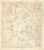
A18-2-5a: Wyoming State Oil & Gas Drilling Map, 1949 A18-2-5b: Map of property(mining lodes) held by the "Galena Ridge Mining Co. in Kirwin, Big Horn Co., Wyoming. "Wood River Mining District" A18-2-5c: Wood River Mining District- 1904; survey of mining lode sections. "Big Horn County, Wyo - complied from official & private surveys of A.B. Gidley U.S. Deputy Mineral Surveyor" A18-2-5d: Yellowstone National Park Map- Topographic; 1928 A18-2-5e: Wood River Mining District- 1904; on a canvas backing Stored together in a long rectangular map box |